
Toledo Street Search Steps
Property research on a Toledo street works as a record chain. Start with the address in the Lucas County AREIS property search, not with a name-only record. The parcel result provides the bridge to ownership and transfer clues. A recorder search then uses the owner’s name and a date range, because the Recorder’s public index is not an address-first tool. The last steps add a narrow check for a known person and historical context. Each source should be read for its own purpose.
- Enter the street number, direction, street name, suffix, and unit in AREIS. Select the correct parcel and record its parcel number, owner, transfer clues, and short legal description.
- Use the county map only to orient the parcel and nearby streets. Keep the parcel number and legal description for the next records, since map boundaries are for tax purposes.
- Search the Lucas County Recorder Public Access index by the owner name and recording dates. Compare its Short Legal entry with the Auditor description, then follow the earlier party when tracing ownership backward.
- For a known person, use the official Lucas County voter lookup as a name-and-county check. It is not a way to browse a street.
- Finish a historic question with the Toledo Lucas County Public Library local-history resources, where maps, directories, and collections can add period context.
This Toledo street directory method can connect an address to public parcel and land evidence. It cannot prove that every person associated with an address lives there now or lived there at the same time.
Toledo Street Address Fields
AREIS separates the parts of an address instead of treating the full line as one loose phrase. That matters when a direction, suffix, or unit distinguishes two records. Its Advanced mode also publishes the filters most useful for narrowing a large street result. The portal describes property and tax information for the current tax year as a reliable reference rather than a guarantee, and it warns that maintenance can affect the newest update.
| AREIS field or tab | Input type | Required | Published option or use |
|---|---|---|---|
| Address | Mode | No | Street number, direction, street name, suffix, and unit. |
| Owner | Mode | No | Owner-name search. |
| Parcel Number | Mode | No | Parcel identifier. |
| Assessor # | Mode and text | No | Assessor-number search. |
| Advanced | Mode | No | Acreage, value, rooms, delinquent year, land use, legal description, market area, municipality, owner occupied, sale data, square footage, stories, street name, tax district, year built, and ZIP Code. |
| County Map | Mode | No | Map-based parcel lookup. |
| Multi-Year Search | Mode | No | Returns prior-year results. |
| Sort by / Results per page | Dropdown | No | Published examples include Parcel ID and 25 results. |
The Auditor’s GIS resources show the public mapping side of a Toledo street directory search.
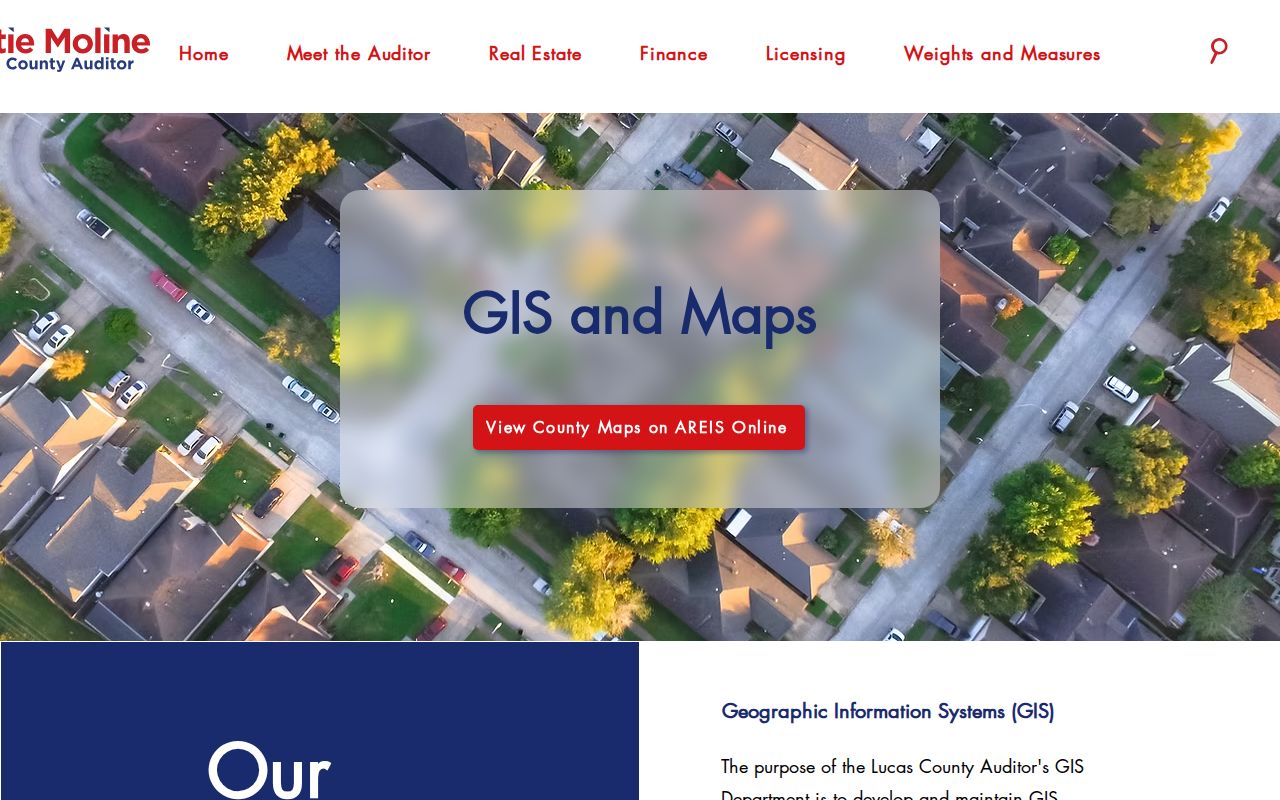
The image is a starting point for locating a parcel. The parcel record, not the picture of a boundary, supplies the ownership, transfer, and tax-related evidence.
Toledo Street Record Coverage
Several Toledo record systems can touch the same address, but they do not make the same claim. AREIS is the active parcel bridge. The Recorder preserves land instruments and uses names, dates, and legal information. City permits add project dates. Library sources help place an older address in its neighborhood and time. A street directory search is more dependable when the record type is matched to the question.
| Address-related record | Keeper | What it can show | Access or limit |
|---|---|---|---|
| Parcel and tax record | Auditor AREIS | Owner, values, tax-account components, attributes, and parcel link. | Current tax-year reference; verify a selected parcel’s fields. |
| Parcel map | Auditor GIS / AREIS | Parcel location, streets, imagery, and maintained layers. | Tax-purpose locator, not a legal survey. |
| Deed or land instrument | Lucas County Recorder | Named parties, date, instrument, legal description, book or page, and recorded consideration. | Online documents begin in 1985; older index channels are in the office. |
| Permit history | City of Toledo | Dated permit or project records associated with an address. | Account portal with address search and an optional date range. |
| Historic map or block card | TLCPL / Library of Congress | Building, streetscape, or historic assessment context. | Archive evidence, not a resident roster. |
The Treasurer’s parcel-tax printout is another adjacent reference source.
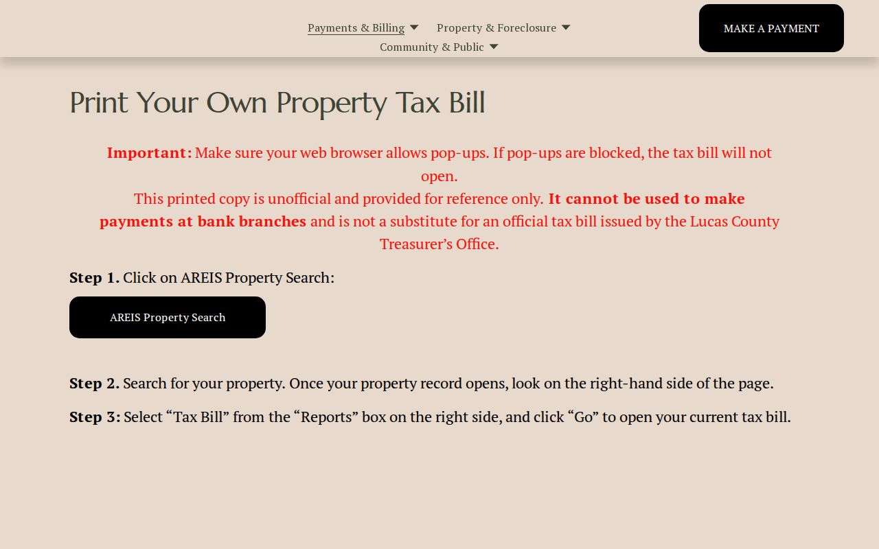
The printout is expressly unofficial, so the issued tax bill remains controlling. Use it to compare a parcel account, then obtain an official bill or record from the responsible office when needed.
For a Toledo address that needs a city-held record beyond the permit portal, use the City’s public-record request channels for property, fire, police, or other categories. The request should name the relevant address or incident facts and go to the office that holds the material. That is a fallback for a specific City record, not a way to assemble a broad list of people connected with a street. Zoning and planning questions may also involve the Toledo-Lucas County Plan Commission, whose address-related work is distinct from the Auditor parcel record.
Toledo Street Parcel Map Limits
Auditor mapping can display parcels, streets, aerial imagery, floodplains, school districts, wetlands, census tracts, and other maintained layers. It is useful for seeing which parcel belongs to an address and for checking the general shape of a block. The County’s published notice is important: GIS boundaries and data need independent verification, and they are not a legal description. Use the map as a locator, then return to AREIS and the Recorder for record evidence.
- Parcel
- The Auditor’s identified piece of property, used as a bridge between map and property record.
- Situs address
- The physical street location used to find a parcel.
- Mailing address
- The place where tax correspondence is sent. It can differ from the situs address.
- Legal description
- The recorded lot, subdivision, metes-and-bounds, or similar description that connects a parcel to an instrument.
- Plat
- A recorded subdivision or lot map that supplies land-description context.
A parcel number is not a ZIP Code, and a map label does not replace the legal description. Those distinctions prevent an address match from turning into an unsupported conclusion.
Toledo Street Owner-to-Deed Trail
The Recorder’s own guidance supplies the practical sequence: begin with the current owner and purchase date from AREIS, then use the Recorder’s name search with the matching date range and party role. The Short Legal field and instrument type help separate a likely conveyance from unrelated filings. A grantee on a purchase deed becomes the current owner; the former owner appears as the other party. For an earlier link, record that seller’s name and date, then look for the seller as a prior grantee in an earlier range.
Keep the legal description, book and page, or instrument ID at every turn. The Recorder cautions that recorded instruments often do not state a street address. Its name index has no address-first or ZIP search mode, so an address from AREIS is only the beginning of the land-record search. This is why the parcel and short legal belong in a street-by-street notes trail.
Useful match check. Compare the Auditor’s short legal description with the Recorder result before treating a similarly named party or a nearby address as the same property.
Toledo Street Permit History
City permit history is an address-dating layer, not a household directory. The City’s instructions require an account, then a Search Location or address entry. A date range can narrow the results, but it is optional. Select a result and use View Project Info for the available project detail. That process can establish that the City recorded work at an address without establishing that every named party stayed at that location.
The City’s permit-history instructions show the official address-search route.
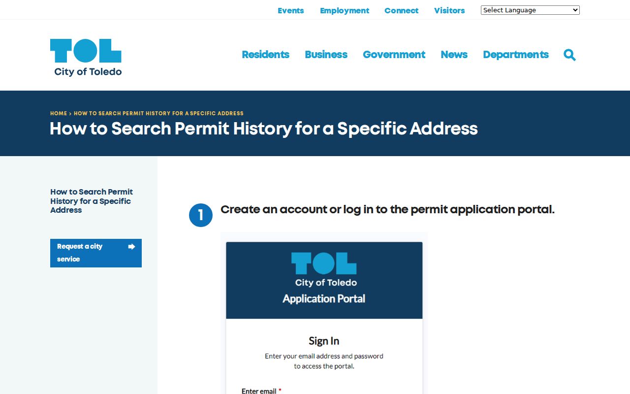
Use dated project entries alongside parcel and deed evidence, especially when a change to a building helps place an event in time.
The City’s permit application portal is the official entry point for permit business.
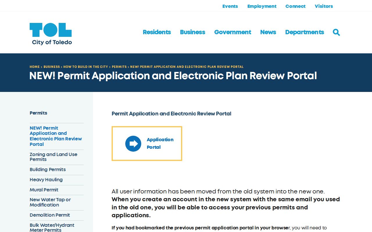
For property, zoning, code-compliance, or building materials not visible through the portal, a City property-record request is the appropriate fallback.
Toledo Street Voter Check
Ohio’s official My Voter Information search is designed to verify a registration and locate precinct or polling information. Its initial form requires first name, last name, and county. Selecting Lucas County narrows a Toledo check. The Lucas-specific public form presents last name as required and also provides first name, Submit, and Reset controls. A later street selector can narrow an already initiated lookup, but neither form is a block or street browse.
A returned public result can display registration and polling information, subject to Ohio exclusions for items such as protected addresses and Safe at Home records. Record only what is needed for the named-person question. A failed result calls for a question to the Lucas County Board of Elections, not a conclusion that the person has never been registered.
The difference between a parcel search and a voter check is important on a Toledo street. AREIS may narrow property records by street name or ZIP code, while the official voter form begins with a known person’s name and county. Its later street-name selector only narrows an already initiated lookup. Do not convert that sequence into an unsupported street-wide roster, and do not treat a protected or absent registration entry as something to work around.
Toledo Street Records Before 1985
The Recorder’s guidance places documents online from 1985 forward, while the general index is on microfiche from 1972 through January 2, 1985. Earlier records use handwritten indexes in the Recorder’s office. Plats have a different reach: the online system reports plats back to 1815.
This online-to-microfiche-to-handwritten transition is more useful than a broad claim that all deeds are online. For a family or property history that crosses 1985, carry the parties, approximate year, legal description, and instrument references to the office. The County Records Center stores material for many county offices but directs public requesters to the office that created the record.
Toledo Street History in Plats
Older Toledo land descriptions can use place names that do not look like a modern street address. City plat materials identify Port Lawrence, Vistula, Ironville, East Toledo, Englewood, Junction, Old South End, Old West End, Lagrange, and North River. When an early address does not align cleanly with a current parcel, compare the legal description and plat name before assuming the street number has a direct modern match.
The City’s digital Toledo plat maps preserve that local context.
In 2025 the City received a grant to preserve roughly 660 pages of nineteenth-century hand-drawn plats, and in March 2026 it announced the public release of more than two dozen scanned maps. Those files can clarify a historic addition, but the recorded legal description remains the property match.
Toledo Street Record Limits
A street address does not open a complete list of people connected to a property. A visible owner does not automatically identify an occupant or every household member. Private utility and delivery information, motor-vehicle address data, protected voter information, and Safe at Home residential addresses remain outside this record chain. The strongest conclusion is the narrow one supported by the particular parcel, instrument, permit, or archive record.
Lawful personal use. Use public address records for a legitimate personal or historical purpose. Property lines, ownership fields, and index results do not authorize contact, intimidation, stalking, or harassment.